
Site Selection and the Path to Approval
Seaports and Waterdromes, Article 3 of 8 | By Captain John Goulet | Goulet Aviation Services
When the first seaplane operations started in the Maldives, the regulators faced a problem every new-to-seaplanes country faces: no precedents. Their solution was elegant. Operators would be granted permission to conduct proving flights to new locations, and each flight would produce the documentation, a route guide, that set the standard for everyone who followed. As the company’s Operations Manager, I was authorized to carry out first-ever landings at eighteen locations, including the northernmost lagoon in the northernmost atoll. It was a big deal, and the island Chief organized a welcoming party with fresh coconuts. During the ceremony, I said how privileged I felt to be the first pilot ever to land an airplane in his atoll. He hesitated, then pointed to a shallow corner of the lagoon. In the war, he said, a British Hurricane fighter caught fire, and the pilot flew it into the water there. He paused thoughtfully. The airplane is still there. You will be the first to take off again.
I keep that story at the front of this article because it contains the whole discipline of site selection in miniature. The lagoon looked like open water to the guests on the beach. To the operation, it was a surveyed site with documented depths, hazards, approaches, and procedures; to the regulator, it was a precedent that established a standard. And even that untouched lagoon had an aviation history worth remembering, as noted in Article 1: we are rarely the first. This article walks through how a stretch of water becomes a water runway: what physically qualifies, how the survey is done, and the different paths by which authorities around the world say yes.
What Physically Makes a Runway Out of Water
Start with the good news: the criteria are published. The ICAO Asia Pacific guidance on water aerodromes, which I helped develop as the sole consultant on the working group, sets out dimensions and clearances that any authority can adopt, and they are refreshingly sensible. The table below gives the core figures, and my field translation of each.
| Element | APAC guidance criterion | What it means on the water |
| Water runway length | Adequate for the operational requirements of the aircraft intended to use the site | Performance-based: about 800 m serves a Caravan, 1,000 m gives a Twin Otter or Caravan comfortable margins at gross weight in still air |
| Water runway width | Not less than 60 m wherever practicable | Room to correct a swing on the step with margin on both sides |
| Water depth | Not less than 1.8 m, or 0.3 m below the hull or floats stationary and loaded, extending 30 m each side and 60 m past each end | Survey at low water; a runway that vanishes at low tide is a landing site, not a waterdrome |
| Turning basins | At runway ends where necessary; runway depth carried through; 15 m clear of the nearest obstacle | A seaplane turns like a weathervane in wind; the basin is where it does so without meeting a mooring line |
| Taxi channels | Not less than 45 m wide, at runway depth, with wingtip clearance for passing traffic | The marked path between runway and dock, kept clear of moored vessels and swimmers |
| Approaches | Obstacle limitation surfaces clear of masts, cables, towers, and terrain on the approach and departure paths | The invisible half of the aerodrome, and the first thing an inspector should ask to see plotted |
Two of these deserve emphasis, because they are the two that kill more candidate sites than all the others combined. The first is depth at low water. A bay that carries three metres at the afternoon high tide and dries to mudflats at dawn is not a shallow waterdrome; it is a part-time landing site, and the tide tables, not the brochure, decide its schedule. The second is the approaches. The water can be perfect while a single power cable strung across the far end of the bay makes the site unusable, and cables are nearly invisible from the air. I have rejected more sites for what stood around the water than for the water itself.
And running through it all is the wind. A water runway is aligned with the seasonal prevailing winds, or it is a compromise, because a seaplane wants to take off and land into the wind. Unlike an airport, we cannot pour a crosswind runway into concrete: the geography either allows a second alignment, or it does not. Establishing that seasonal wind picture, from government climate records for the submission and from the modern forecast tools for operations, is a discipline of its own, and I have covered it in depth in the companion articles on weather tools and on the judgment that goes with them. For site selection, the summary is: learn the monsoon calendar, or its local equivalent, before you fall in love with a bay.
The Survey: A Funnel, Not a Visit
How do you actually assess a candidate site? My method has settled, over some thirty water aerodromes and hundreds of scouted landing sites in eighteen countries, into a four-stage funnel. First, the desk study, to answer the four basic questions I ask of all pilots carrying out a reconnaissance flight for the first time: 1. Where do you need to take the passengers? 2. Where can you land and safely taxi to where they need to go? 3. Where can you take off? It might be a different waterway or direction than the one you landed on. 4. How can you safely taxi to the takeoff site?
Satellite imagery answers the brutal questions cheaply: is there a straight kilometre of water aligned with the prevailing wind, clear of reefs, moorings, and ferry routes, with somewhere to put a dock? On Google Earth and ForeFlight, I run the distance ruler. They are both highly accurate. For a more in-depth look, I set an overlay of a scaled water runway template on the imagery, turning basins, overrun zones, taxi channel and all, and slide it around the bay until it fits or it does not. A template that will not fit anywhere is a cheap answer to an expensive question, and it has saved me time on a great many site visits.
Second, the climate study, based on government records for the reasons explained in the weather tools article, means the CAA cannot refute its own government’s data. Seasonal wind roses set the runway heading and expose the crosswind season; tide tables set the low-water survey datum; cyclone and monsoon records set the operating calendar.
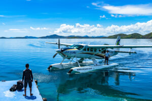
Third, the reconnaissance, because no satellite sees a sandbar at half-tide, a newly installed cable or cell tower, or the afternoon venturi between two headlands. If necessary, I sound the waterway and channel at low water, but for the most part I watch the water surface. Even if the water is murky, I can gauge its depth by the surface’s calm or turbulence. I can see deep water in the lines of the flowing water.
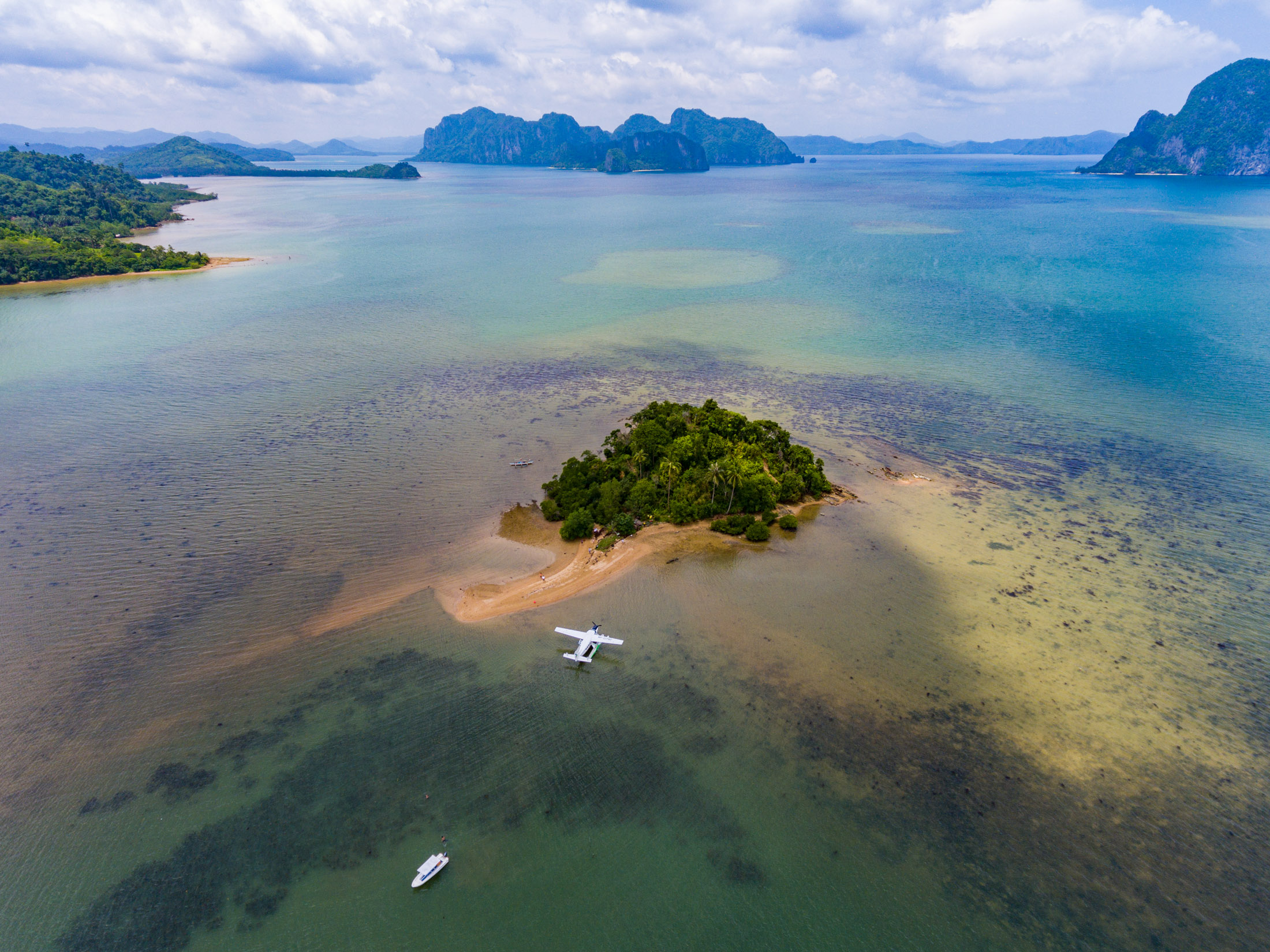
Ironically, the most difficult depth to judge is in severe clear waters. A coral reef or boulder may be 1 meter or 20 meters deep. It’s hard to tell. In the ocean, I go by the water colour. Light green is shallow, light blue is deep enough, dark blue is very deep. But severe clear water such as in Great Bear Lake is nearly impossible to read. Luckily, no matter where you want to land in these northern Canadian lakes, someone has gone before you, and the safe areas are, for the most part, mapped out.
I then plot every obstacle on the approaches, watch the marine traffic on a working day, and talk to the people who use the water: fishermen first, because they know where the shallows are, and they were here before you. Where the operation is already flying, the reconnaissance may be a proving flight on the Maldives model, flown by an experienced pilot under the Operations Manager’s authority, producing the site’s first documented arrival and departure. Contrary to common sense, it is much easier and quicker for an experienced seaplane pilot to judge water depth and spot hazards during a low-level recce. I only use a boat if there is no seaplane available.
Fourth, the documentation. Everything the funnel produced- coordinates, diagrams, depths, hazards, procedures, and photographs- lands in one document: the route guide entry, the mini aerodrome manual for that site, approved under the operator’s AOC. The route guide gets its own article later in this series, so here I will say only this: the survey is not finished when you know the site works. It is finished when a pilot who has never seen the site can brief from your pages and arrive as if he had.
Four Paths to Yes
Now the regulatory half, and the reason this article speaks of approval rather than certification: certification is only one of the doors. Which door to knock on depends on the country, and knowing which one to knock on is half of my consulting practice.
The registration path, Canada. It should tell you something that the country with more seaplanes than any other barely regulates the establishment of water aerodromes. In Canada, an aerodrome, water included, may be established and operated, and registration under Subpart 301 of the CARs puts it in the Canada Water Aerodrome Supplement with its diagram, jurisdiction, and cautions, the Jeppesen of the seaplane world. The regulator’s effort goes into published information and operating rules, not gatekeeping, and a century of safe operations says the model works.
The advisory path, United States. The FAA’s Advisory Circular 150/5395-1B, Seaplane Bases, provides planning and design standards, and the FAA reviews the site’s airspace. Still, much of the approval ultimately rests with state and local authorities, who range from enthusiastic to allergic. The lesson for operators is that the aviation authority is not always the tallest hurdle; the lesson for authorities is that a published national design standard makes every local conversation shorter.
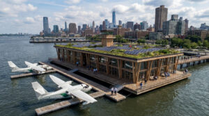
The certification path, the APAC model. For countries building a framework from scratch, the APAC guidance and its sample regulations provide the tiered structure from Article 1: certified waterdromes for the commercial hubs, registered stations with basic infrastructure for the resorts, and landing sites documented under an AOC holder’s own protocols for everything else. Egypt’s proposed framework, which I helped draft, applies exactly this structure to a national network, from a certified Nile waterdrome in Cairo to coded stations and remote sites down the river and along both coasts, each tier carrying paperwork proportional to its traffic.
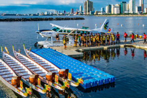
The precedent path, everywhere else. And where there is no framework at all? Then you are hunting precedents. In Manila, I wanted a seaplane base in the great natural harbour, avoiding the container port area to the north for the marinas to the south, and CAAP said what CAAs without frameworks always say: no precedent. After some digging, I produced three. Pan American’s China Clipper had landed in Manila Bay on schedule from 1935. The U.S. Navy had operated a wartime seaplane base at Sangley Point. And an American pilot known as Subic Mike was flying a 1954 Cessna 180 on floats off a hand-drawn map of harbour operating lanes that looked, let us say, informally issued. A precedent is a precedent; CAAP granted my permission. They also denied ever authorizing Subic Mike, and asked me to suggest, nicely, that he turn himself in, his licence having expired two years earlier. The serious point: the question a regulator should ask is never “has this been done before”; it is “can this be done safely,” and the APAC guidance now exists precisely so that no country needs to rely on Subic Mike’s map.
Matching the Tier to the Traffic
The last selection decision is the regulatory scale, and it belongs in the business plan as much as the safety case does. Standards should scale with a risk assessment based on movements and passengers carried, certified waterdromes where seaplanes meet cities, daily schedules, registered stations where they meet resorts, and documented landing sites where they meet a beach twice a season. Indonesia, with seventeen thousand islands, has four certified water aerodromes; the Philippines, with seven thousand six hundred, has two. Neither number is the constraint on those countries’ seaplane development; the insistence that every viable lagoon needs certified-aerodrome paperwork is. The Maldives, with the busiest seaplane operation on Earth, individually approved roughly 86 resort water-landing sites precisely because that is where the traffic is, according to each airline’s route guides. The MCAA only regulates the airport-adjacent waterdrome. Right-sizing the tier is not regulatory laxity. It is what actually makes safety oversight affordable enough to happen.
What This Means for You
For the inspector: ask for the funnel, not just the outcome. A credible applicant shows you the overlay on the imagery, the government climate data behind the runway heading, the low-water soundings, the obstacle plot, and the route guide entry, and a tiered framework gives you a proportionate shelf to file it all on. For the harbour master and port manager: the survey stage is where you want to meet the operator, not the application stage; your knowledge of traffic, moorings, and seasonal water belongs in the site assessment, and the operator who seeks it out is showing you how they will operate everything else. For the operator and investor: the site survey is the most valuable document your new operation will ever produce. It is the difference between buying a waterdrome and buying a lawsuit with a view, and at desk-study prices, the cheapest insurance in aviation.
Where We Go from Here
A site, then, is selected four times: by commercial need, by water, by climate, and by authority, and the operator’s job is to document all four so thoroughly that the next selection becomes a formality. What the survey cannot do is put a dock on the shoreline, fuel in the tanks, or transfer passengers safely across the gap between them. That is construction, procurement, and the infrastructure nobody budgets for, and it is where this series goes next: building the waterdrome.
References
ICAO Asia Pacific Regional Office, Regional Guidance on Requirements for the Design and Operations of Water Aerodromes for Seaplane Operations (water runway, depth, turning basin, taxi channel, and obstacle limitation criteria); Sample APAC Regulations for Water Aerodromes.
Transport Canada, Canadian Aviation Regulations, Subpart 301, and Advisory Circular AC 301-002 (aerodrome registration); NAV CANADA, Canada Water Aerodrome Supplement.
FAA, Advisory Circular 150/5395-1B, Seaplane Bases, 31 August 2018.
Proposed seaplane water landing locations and regulatory framework for Egypt (ECAA submissions, Goulet Aviation Services consulting work).
Companion articles: Cool Seaplane Pilot Weather Tools, Revisited, and Common Sense and Seaplane Flying, Revisited.