
How Working Ports and Seaplanes Run the Same Water
Seaports and Waterdromes, Article 6 of 8 | By Captain John Goulet | Goulet Aviation Services
The most important document in this article is a brochure. It is printed on waterproof paper, published by Transport Canada, and handed to anyone who operates a boat in the Port of Victoria, British Columbia. On one illustrated page, it shows two seaplane runways, the speed limits, the traffic lanes for every class of vessel, the two places where boats may cross a runway, and the strobe lights that mean an aircraft is about to use it. With that page, a harbour that hosts ferries, tugs, water taxis, kayaks, whale-watching boats, a cruise ship terminal, and up to one hundred seaplane movements a day has operated safely for decades. I have spent fifty years being told, in ports around the world, that seaplanes and shipping cannot mix. This article is the factual reply, written for the port authorities, harbour masters, and civil aviation inspectors who need evidence rather than assurances. Three jurisdictions have already solved the problem in three different ways, all published, all audited, and all in daily operation: Victoria, Vancouver, and the Maldives. Here is exactly how each one works.
The Problem, Stated Honestly
Article 2 of this series established the legal position: a seaplane on the water is an aircraft with the manners of a vessel, the give-way party to everything afloat under COLREGs Rule 18(e) and its national mirrors. The genuine safety question is narrower than most objections admit. It is the takeoff and landing run, roughly a minute in each direction, when a machine doing eighty knots occupies water where everything else does five. A regulator’s reflex is to separate the two in space, banning the seaplane or exiling it beyond usefulness. The proven answer is to separate them in time: define where the seaplane runs, mark it, signal when it is active, and publish the rules so that every skipper in the harbour knows them. That is not a theory. It is the operating principle of every case that follows.
Victoria: The Whole Solution on One Page
Canada, with more seaplanes and water landing sites than any nation on Earth, operates a family of established water airports: the Vancouver Harbour Flight Centre with its floating terminal in the downtown core, Nanaimo Harbour on Vancouver Island coordinating commercial connections to the mainland, Bedwell Harbour on South Pender Island serving as a seasonal international entry point complete with customs services, and Dryden and Fort Frances in Northwestern Ontario supporting regional transport, cargo, tourism, and the water bombers of the forest-fire season. Within that family, Victoria Harbour, CYWH, is the second-busiest and, I would argue, the most complex: up to one hundred movements a day, year-round, threaded through a harbour that is also a ferry terminus, a cruise port, and a paddling destination. What makes Victoria work is worth studying line by line, because its traffic scheme is the most complete integration of aviation and marine traffic ever published, and it was developed, in the scheme’s own words, by both port users and regulators, fishermen, ferry operators, paddlers, and pilots at the same table.
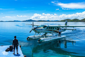
The anatomy is simple enough to summarize in a paragraph. Two seaplane runways are defined, one in the Middle Harbour and one in the Outer Harbour, active enough to handle upwards of one hundred flights a day. Speed limits govern everything afloat: seven knots in the Outer Harbour, five knots inward of Shoal Point. Every class of vessel has its place: non-powered craft transit along the north shore of the Middle Harbour or in the boat lanes; powered vessels under twenty metres use the small-vessel inbound and outbound lanes; vessels of twenty metres or more may transit the runway areas themselves, without stopping or delaying. All vessels may cross the runways in exactly two places, at the Songhees and Laurel Point narrows and on the straight line between Shoal Point and Berens Island. And the signal that separates the two worlds in time is gloriously low-tech: white strobe lights on four beacons flash when a seaplane is about to take off or land, and nobody crosses while they flash. Sailing under sail is prohibited; anchoring is prohibited; a harbour patrol answers questions on the water; and the whole arrangement carries the force of law under the Canada Marine Act’s practices and procedures for public ports.
Notice what is absent. There is no control tower on the Inner Harbour, no radar, no permanent exclusion of any user, and no expensive infrastructure beyond buoys, beacons, and printing. The scheme separates a hundred daily aircraft movements from thousands of daily vessel movements with paint, light, and shared knowledge. When I tell a port authority that the integration problem has been solved cheaply, this is the document I put on the table.
[IMAGE 2 – FIGURE] Caption: Two crossing points, four strobe beacons, speed limits, and lanes for every vessel class: the anatomy of the Victoria scheme. Use the traffic scheme chart itself, annotated if desired, or your photos of the strobe beacons at Laurel Point.
Vancouver: Full Air Traffic Control in a Working Port
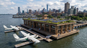
If Victoria proves the problem can be solved with a brochure, Vancouver proves it can be solved at any scale you like. Vancouver Harbour Water Airport, CYHC, is located in Coal Harbour within Canada’s largest and busiest port, surrounded by container terminals, cruise ships, grain berths, floatplane commuters, and a dense downtown. The seaplanes here answer to a dedicated facility: the Vancouver Harbour control tower, perched on top of the Granville Square office tower at 142 metres, the highest air traffic control tower in the world, staffed by NAV CANADA controllers who sequence seaplanes the way any tower sequences airliners. The scale is not boutique. In its busier years, the tower has handled more than fifty thousand aircraft movements annually, and the city-pair between this harbour and Victoria’s harbour, CYHC to CYWH, was once ranked as Canada’s busiest air route by weekly flights. Think about that: the busiest route in a G7 country, by frequency, operated dock to dock between two working harbours.
Vancouver also demonstrates the courtesies that keep a city on its side. Floatplane routings over downtown are designed and published with noise and safety in mind, and coordinated among operators, the airport authority, and Transport Canada, because the licence to operate in an urban harbour is social as well as legal. A port authority considering a seaplane proposal should request both documents: the water traffic scheme and the overflight routing. A professional operator arrives with answers to the neighbours’ questions already written.
The Maldives: A Nation Built on the Model
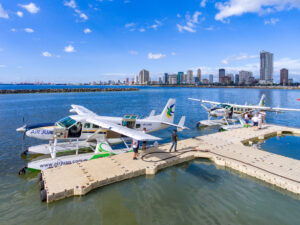
The third case answers the question of scale in the other direction: not one harbour but an entire national economy. Seaplane operations in the Maldives began in 1993 with a single flight from the lagoon beside the international airport. Three decades later, according to the Maldives Civil Aviation Authority’s own figures presented to ICAO’s regional cooperative programme, the country operates more than 70 seaplanes, making roughly 400 movements a day, with the largest operator alone operating 60 aircraft. When the international airport was expanded, the water aerodrome was not pushed aside; it was redesigned and rebuilt alongside it, with more than sixty new seaplane docks and a dedicated seaplane terminal handling seven hundred passengers a day through twenty-seven lounges.
And here the Maldives took the opposite instrument to Victoria’s: the lagoon is not shared water at all. It is closed to boat traffic, official and rescue vessels excepted, a dedicated water aerodrome in the fullest sense. A state does not hand a lagoon beside its international airport to one mode of transport unless that mode is carrying the economy, and the dedication repaid itself, because it is precisely what allowed seaplane operations to grow to four hundred movements a day without conflict. The water aerodrome has three water runways plus a fourth for the westerly monsoon crosswind season, thresholds and taxiways marked by coloured buoys, one runway dependent on the land runway with simultaneous operations prohibited, exactly the kind of dependency any airport planner will recognize and respect.
The regulatory architecture underneath is precisely the proportionate, tiered model this series has advocated since Article 1, written into national law as MCAR 138-A, 138-B, and 138-C. Certification is reserved for water aerodromes that are co-located with a controlled land aerodrome, exceed 100,000 movements a year, or are deemed necessary by the authority; three sites hold that status. Everything else, more than ninety resort floating platforms, is licensed against published standards covering anchoring, buoyancy, safety equipment, and siting factors from seabed depth to maritime traffic to community and environmental impact. Certified and licensed sites are audited annually; remote sites are inspected by the operators themselves under their safety management systems, with reports to the authority and an on-site visit by the authority every three years. On the operational side, the Maldives went beyond ICAO minimums: two pilots on every seaplane even where one is workable, captains holding airline transport licences with three thousand hours including five hundred on floats, cabin crew above nine passengers, transponders and ADS-B in the control zone, and published VFR arrival and departure routes segregating seaplanes from jet traffic, with a dedicated seaplane controller position in the tower. This is what it looks like when a state decides that seaplanes are transport infrastructure rather than a curiosity, and they carry a tourism economy on their backs.
[IMAGE 3 – FIGURE] Caption: Four water runways beside an international airport: the Velana water aerodrome layout, thresholds and taxi channels marked by buoys. Suggested: the water aerodrome layout diagram from the MCAA presentation, redrawn with your overlay template style, or your own Maldives operational photos.
Three harbours, three instruments, one principle:
| Victoria Harbour | Vancouver Harbour | Maldives | |
| The instrument | A published joint traffic scheme on one waterproof page | A dedicated water aerodrome control tower plus published procedures | A national regulation set, MCAR 138-A, B, and C |
| Scale | Up to 100 seaplane movements a day among ferries, kayaks, water taxis, and cruise ships | Canada’s busiest water airport, tens of thousands of movements a year inside the country’s largest port | More than 70 seaplanes and roughly 400 movements a day across a national network |
| Who governs | Port users and regulators jointly, under the Canada Marine Act; certified water airport (CYWH) | NAV CANADA tower, port authority, and Transport Canada | Maldives CAA with tiered certification and licensing; operators inspect remote sites under SMS |
| The lesson | Marked areas, two crossing points, and strobe lights are enough to run a shared harbour safely | Full ATC integration works even beside container terminals and a dense city | Dedicating water to seaplanes, a lagoon closed to boat traffic, scaled operations to 700 passengers a day beside an international airport |
What the Pattern Teaches
Strip the three cases to their logic, and a port authority discovers it holds three instruments, not one. Victoria shares the water by scheme: rules written jointly with the port users, published so that the scheme’s authority reaches every kayaker, since every kayaker can read them, with the seaplane areas protected only when the strobes say so and open to everyone the rest of the day. Vancouver integrates by control: a tower sequences aircraft through a working port the way any tower sequences a runway. The Maldives dedicates by design: one lagoon given wholly to seaplanes; everything else licensed proportionately; a certificate where seaplanes meet controlled airspace; a licence where they meet a resort jetty; and an operator’s own documented SMS inspections where they meet a remote lagoon. A harbour can choose any of the three, or graduate from one to the next as traffic grows, and in every case the marine side is a full partner: harbour patrols, VHF procedures, speed limits, and crossing rules are marine instruments, enforced under marine law, protecting an aviation operation. Nothing in the list requires new technology, and every element has decades of audited service behind it.
The Red Sea Harbours That Have Not Met Their Seaplanes Yet
Which brings me to the harbours this article is really for. I am not preaching to the choir. In the Red Sea and the Mediterranean, Egypt is at the center of the largest port and tourism investment in its modern history, with international port operators developing world-class cruise terminals at its gateway cities and infrastructure intended to make the country a premier cruise destination. The economics of that investment are worth stating plainly, because they are the economics of every cruise port: the terminals earn their keep by attracting ships, and the ships choose their ports by the itineraries they can sell. A port that can offer its cruise lines an experience no competing coastline offers is a port that wins deployments. I have spent much of my recent consulting career on the aviation half of that same coastline: the proposed Egyptian framework of certified waterdromes, seaplane stations, and landing sites described earlier in this series, drafted on the APAC guidance and modelled on precisely the three cases above.
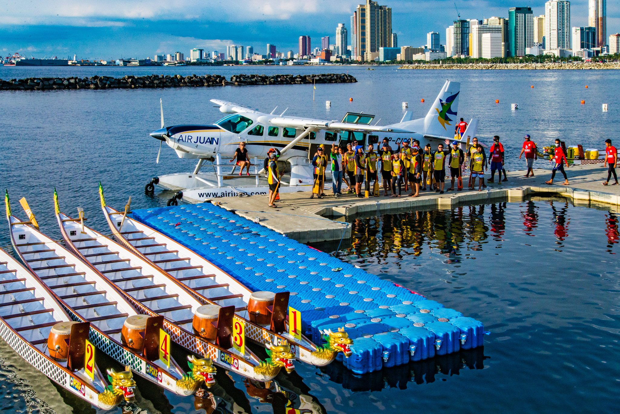
Put the two halves side by side, and the fit is obvious. A cruise passenger at a Red Sea quay is moored beside a coastline whose most spectacular destinations, the reefs, the desert monasteries, and above all the Nile, Karnak and the Valley of the Kings at Luxor, the temples of Abu Simbel, the Pyramids themselves, lie hours beyond the range of a shore excursion bus. Now imagine the same passenger stepping from the ship’s gangway to a floating dock forty-five square metres in size, and standing before the Temples of Karnak in about an hour, having crossed the Red Sea hills and descended the Nile Valley by air, with no crowded airport, no queue, and no motorway, and being back aboard for dinner.
For the passenger, it is the excursion of a lifetime; for the cruise line, it is an itinerary no competing coastline can match; and for the port, it is the difference between a stop and a destination. What does the port itself have to change to make that possible? Almost nothing, and that is the point of this entire article. A page of traffic scheme and possibly but not necessarily a pair of strobe beacons, as Victoria proves; or a dedicated stretch of protected water, as the Maldivian lagoon proves; forty-five square metres of floating dock from Article 4; and the SOPs and route guides this series has already walked through. The seaplane connection is not a novelty to be risk-assessed from scratch. It is a published, certified, and audited operating model waiting to be adopted, and the water in front of every new cruise terminal is the least utilized runway in the portfolio.
What This Means for You
For the port authority executive: the question to put to your team is not whether seaplanes can operate in a working port, because Victoria, Vancouver, and the Maldives closed that question years ago, but which of the three instruments fits your harbour: share by scheme, integrate by control, or dedicate by design. The capital cost of the first is buoys, beacons, and a brochure, and the return is measured in the currency ports actually trade in: the ships your terminals attract. For the harbour master: your existing marine toolkit, speed limits, traffic lanes, VHF procedures, and patrols, is the machinery that makes seaplane integration work, and in Victoria it is marine law, the Canada Marine Act, that gives the scheme its teeth. You are not being asked to learn aviation; you are being asked to schedule it. For the ECAA inspector: certification effort should follow Maldivian logic, concentrating where seaplanes meet controlled airspace and high volumes, and delegated through licences and operator SMS everywhere else, with the audit calendar published and maintained. And for all three: insist on the joint table. Every scheme in this article was written by the water’s users together, and that, more than any single rule, is why they work.
Where We Go from Here
Victoria’s brochure, Vancouver’s tower, and the Maldives’ MCAR 138 are the visible surface of something deeper: documentation that makes safety inspectable. Beneath every one of these operations sits the paperwork this series has been circling since the first article, the route guides, aerodrome manuals, and safety management systems that turn one pilot’s knowledge into an institution’s. The next article opens those documents because, as we say in this business, paper is what keeps the floats dry.
References
Public Port of Victoria Traffic Scheme (Transport Canada; rules under the Canada Marine Act, Practices and Procedures for Public Ports): seaplane runways, crossing points, strobe signals, speed limits, and vessel lanes.
Vancouver Harbour Water Airport (CYHC): NAV CANADA Vancouver Harbour control tower, Granville Square; movement statistics and the CYHC-CYWH route ranking; Vancouver Airport Authority and Transport Canada floatplane routing and noise management material.
Maldives Civil Aviation Authority, Seaplane Operations in the Maldives, presented to the COSCAP South Asia 30th Steering Committee Meeting, January 2023: fleet, movements, Velana water aerodrome redevelopment, MCAR 138-A/B/C, certification and licensing criteria, and oversight regime.
ICAO Asia Pacific Regional Office, Regional Guidance on Water Aerodromes for Seaplane Operations; earlier articles in this series for the legal framework (Article 2) and site and infrastructure standards (Articles 3 and 4).